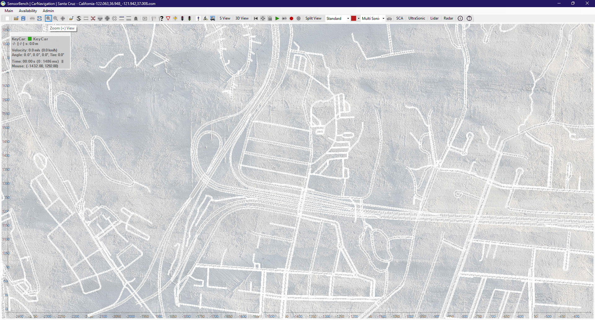
SensorBench. Car Navigation.
![]()
design the car of the future, with an optimal sensor attribution.
Simulate your adequately configured car on the Road Network of your destination.
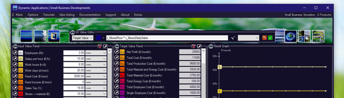
SensorBench is a configurable, rule-based simulation environment for the Car industry. Travelling people and packages from A to B, the basics of modern Transport, of society.
The purpose of SensorBench is to represent a decent, adequate, standalone and rule-based driving simulation, to allow for a car configuration with a reasonable set of modern Sensors.
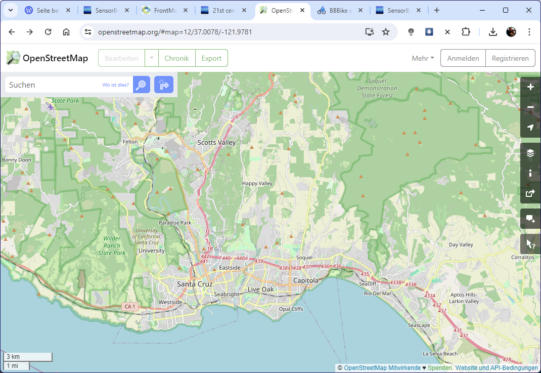
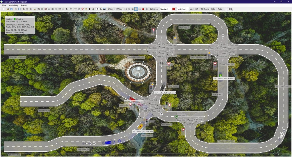
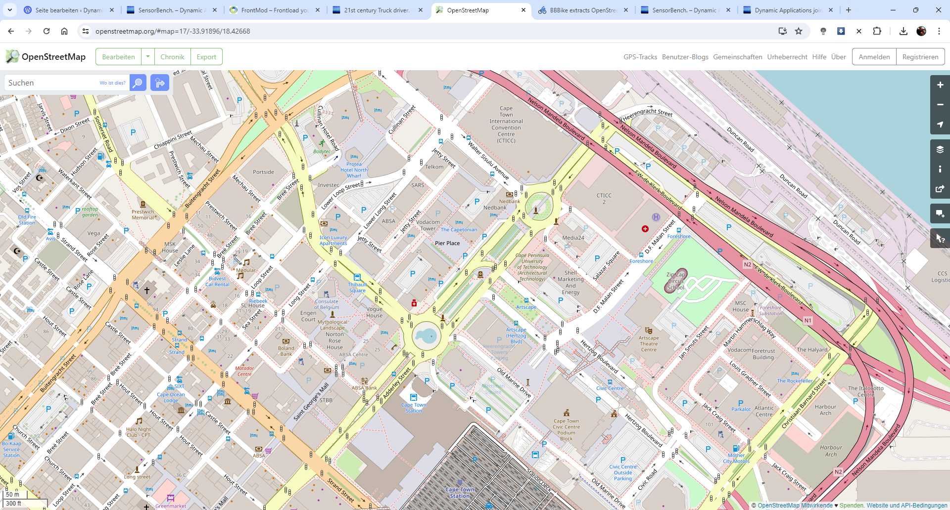
Through OpenStreetMap, it allows to incorporate Road Networks from all around the Earth.
Almost.
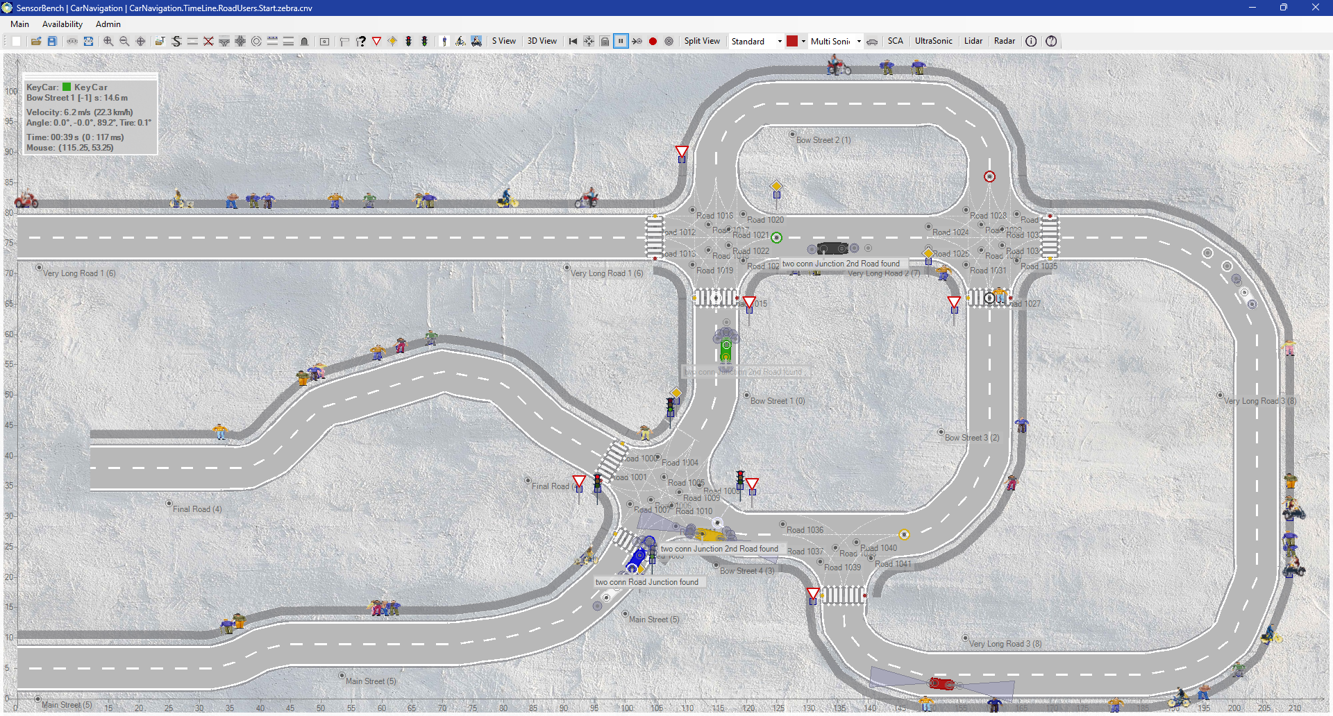
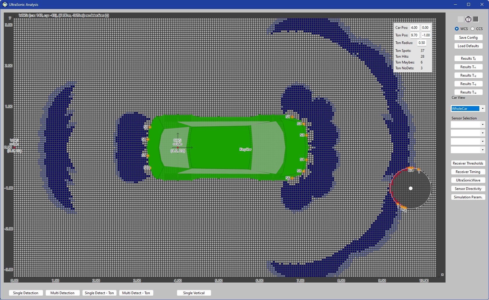
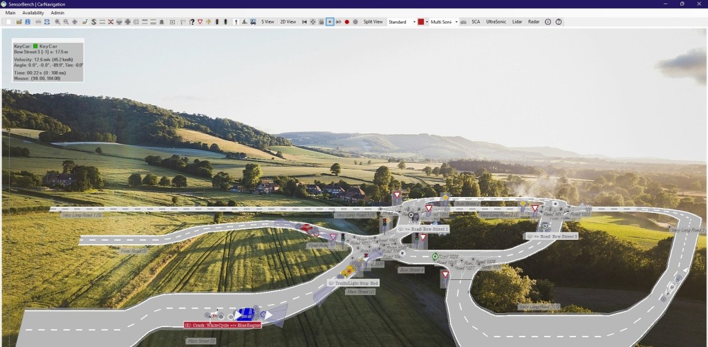
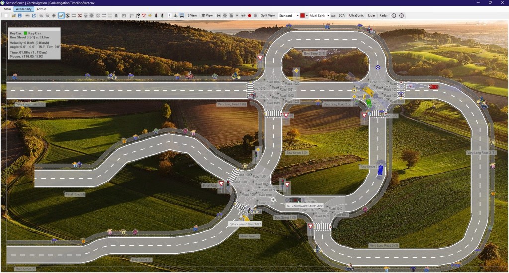
SensorBench supports Street Maps from OpenStreetMap and OpenDrive, to place coloured Cars on the Street network, let the cars drive along the streets, and follow a few rules hereby, for example, right before left at Crossings. Furthermore, SensorBench includes a few Sensor-specific Modules, namely UltraSonic, Radar, Lidar and Camera, with customizable, fine configuration.
So you can design the minimum car that fulfils your requirements, in rule-based driving.
.. .
earth oil, nature’s longest term substance, also plays an important role in car development.
should we go any further along the time axis, we’d arrive briefly at the question of horse powers.
so what’s an adequate value of producing world’s most popular transport vehicle, may we ask.
deciding the life qualilty of millions of people, shouldn’t that be a most adequate, decent value?
. ..


..
From Startups to well-established Car Manufacturers, SensorBench focusses on a small, but well-functional series of relevant Topics around ADAS – Advanced Driver Assistance Systems.
We allow you to Simulate your brand-new Car in a realistic environment, including the ability to incorporate Cars with realistic UltraSonic, Radar, Lidar and Camera Sensors, and let them navigate through a Navigation Route from Start to Target. Through OpenScenario XML, a standard for the German Car industry, our customers can configure relastic scenarios of driving in a fine-distance, automated activation of brakes, lane changing, and overtaking of slower cars.
So you can elaborate how many Sensors you need to incorporate with your new car.
For crossings, an adaptive approach can replace simple OpenStreetMap crossings with OpenDrive-compatible crossings with lanes.
..
![]()
SensorBench.
Car Navigation.
![]()
Explore your fully functional 30-day Test version of SensorBench today.
..
SensorBench has been created in cooperation with FrontMod GmbH, a startup from Germany, who are the official product publisher. FrontMod GmbH is responsible for the Sensor Modules – UltraSonic, Radar, Lidar and Camera support. Dynamic Applications is the software manufacturer. We’ll be grateful for the chance to present SensorBench in a Skype meeting.
Details for contacting Dynamic Applications you’ll find on the Impressum | Contact page.


SensorBench. design the car of the future, with an optimal sensor attribution.
Simulate your adequately configured car on the Road Network of your destination.
Compatibility Note:
Due to the stucture of OpenStreetMaps, there is only one central road line. With OpenDrive, we support to drive along specific road lanes, for example, driving a connection lane in a crossing.
..
SensorBench.
Car Navigation.
UltraSonic and CarNavigation modules are fully functional.
Explore your fully functional 30-day Test version of SensorBench today.
No data gathering, no Server behind you. rule based car development. Just the pure thing.

Thank you for choosing Dynamic Applications, today. Comment section is open.
